
Tips and resources

New to commuting?
Here’s our guide to finding a bike-friendly route for your next journey.
A guide to new riders
Planning a bike route
In many places, travelling by bike is the fastest way to get around, the best option to avoid sitting in traffic and it means you don’t ever have to worry about finding a park. With a little planning and know how, you will be able to access some much more efficient and enjoyable routes on two wheels.
There are heaps of tools to help you plan a bike-friendly route and knowing the benefits and limitations of each will make your experience a lot easier. “The best app” really depends on where you live, but if you’re a new bike rider, here are a couple of options for you to consider when planning your next journey.
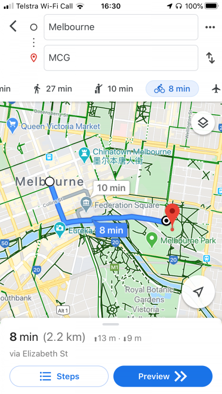
Google Maps
Getting directions
Google Maps has a handy bike route feature that provides recommended routes for getting from A to B on two wheels (simply swipe through the transport modes when getting directions). It even provides an estimated ride time (assuming you are travelling at 16km/h) and elevation for your chosen route.
Despite the extensive map network, you should still be cautious when selecting a route via Google Maps and following the turn by turn directions. While it seems quick and easy, the suggested routes do carry an apt warning that “bicycling directions may not always reflect real-world conditions”.
Need more help? Here are some step by step instructions for navigation via the Google Maps app.
Handy hint
Not familiar with a road on your suggested route? If you haven’t ridden in the area before it can even be worth checking out Google Street View to inspect any roads before using them IRL.
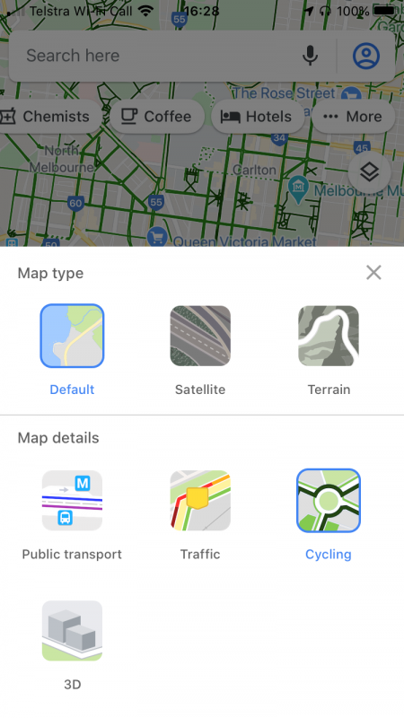
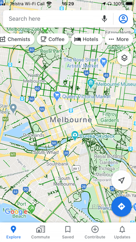
Using the cycling map layer
To help guide your route planning we recommend adding the ‘cycling layer’ (under map details) to your map for an overview of existing bike lanes and trails.
While the entire bike network is not fully covered, you’ll often be able to use the feature to find an alternative (and sometimes more efficient) option running nearby Google’s suggested directions.
Legend

Bike Citizens
Bike Citizens is a useful route planning tool and nice app for people who ride bikes, especially when looking for the most bike friendly route available.
Simply input your origin/destination and select if you’d like your route to be easy/balanced/fast. The easy route option makes the most of available dedicated trails or bike lanes, where as the fast route option will prioritse time and provide the most direct route.
Handy hint
A unique feature available within the route planner is the ‘five minutes by bike’ function. It focuses on riding time rather than route options to show how far you can travel by bike in 5, 10, 15 and 30 minutes (displayed as a network of possible routes around your point of origin). Visit the route planner and select ‘5 minutes by bike’ as your routing mode to give it a try.
Strava – with a paid subscription
While Strava is often seen as being targeted at cyclists, its route builder (available with a paid subscription) is another handy tool for determining the most bike-friendly option. If you’re new to the game, there’s often a free trial available to take advantage of the feature.
The data for route recommendations is drawn from the most popular routes taken by other users, it’s easy to find some very bike-friendly options.
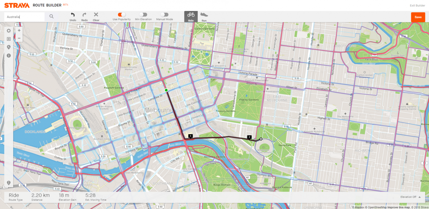
Route builder
Simply select your start and finish location and Strava will draw a suggested route that you can save to your profile for future reference via the mobile app. You can also set multiple markers along the route if you already have a rough idea of what road you will be taking.
Your estimated moving time is calculated by your 4-week average speed (from previous use of the app) and doesn’t take into account stopping, traffic lights, etc. If you want to avoid hills or get an idea of the terrain, you can use the elevation profile to get a gauge.
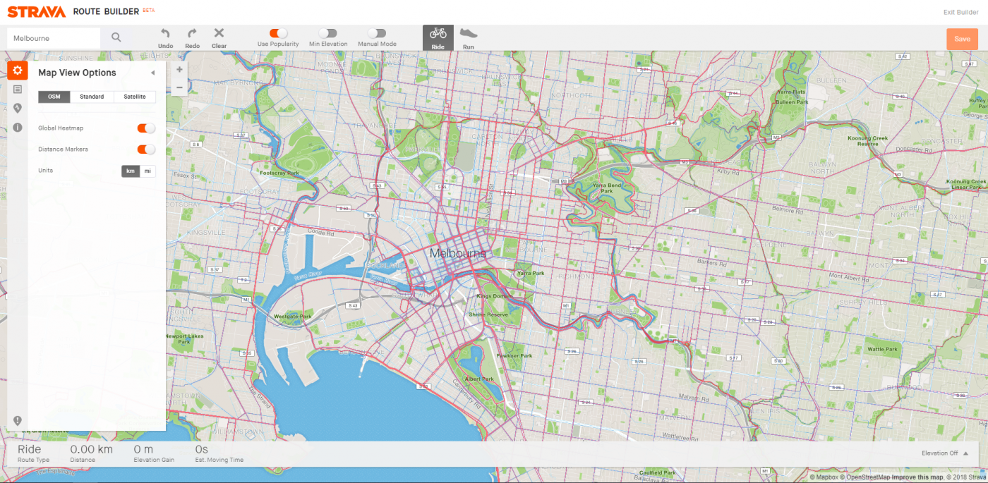
Global Heatmap
One of the best features is the ‘Global Heatmap’ tool which gives a helpful visual on where most people are riding. You toggle this on via the Map View Options.
Please note, since a large amount of users will opt for the most direct route, some of the more ‘popular roads’ may not have a separated bike lane or trail, so if you’re a new rider it’s handy to use the heatmap in conjunction with a separate map of dedicated cycling trails to find a route you’re comfortable with.
Other tools
There are heaps of bicycle route planning tools and they’re all worth trying out to find one that works for you.
Some other apps to take a look at include:
- City Mapper (the “quiet” route option helps you make the most of dedicated bike lanes and trails)
- Komoot
- Ride with GPS
Ask a mate

Got a friend who loves to ride bikes? They are often one of your best sources of information when it comes to finding the most bike-friendly route.
If you’re planning a new commute to work, it’s often a good idea to do a practice ride on the weekend when roads are quieter so you can become more familiar with your route.
Don’t forget, if you ever find yourself on a road where you’re not comfortable riding, you can always hop off and walk along the footpath to navigate a tricky situation (VIC & NSW 🙄) or ride on the footpath (all other states).
Find a local bike-friendly Facebook group
There are lots of bike-friendly Facebook groups such as ‘People Who Ride Bikes – Melbourne‘ or ‘Melbourne Bike Paths‘ where you can ask questions and get tips & advice about riding locally. Simply do a quick search and you’re sure to find a group based in your local area with lots of other bike riders keen to give advice.
Become our friend
Find out more about Bicycle Network and support us in making it easier for people to ride bikes.