
TRANSPORT SURVEYS AND DATA
AIRS is an automated survey method that uses AI technology to capture pedestrian, bicycle and vehicle traffic data. It provides real-time solutions to traffic management, resource allocation and urban planning decisions.
Information BookletWhat is AIRS?
Traffic and transport data surveys
Bicycle Network is offering Artificial Intelligence Road Surveys (AIRS) as part of our suite of complementary Super Count surveys.
AIRS autonomously detects and classifies roads users from video footage, and provides insights into how they interact within road environments. Developed by Vivacity Labs, the technology uses cameras, sensors and machine learning to detect and classify up to nine road user types in a given field of view with 97% accuracy.
From active travel volumes to motor traffic congestion and movements, AIRS can be uniquely tailored to meet transport planning, monitoring and evaluation objectives.
enquire nowPlease note: This video is a demonstration of how the AI software performs and is not utilising the data privacy mode, which can be used to automatically anonymise data.
What data can AIRS provide?
AIRS can provide decision makers with the traffic and active travel data they need to make evidence-based decisions.
Once the AI-technology has identified and classified all users in the field of vision of the sensor or camera, Bicycle Network’s analysts can provide reports on three key areas.
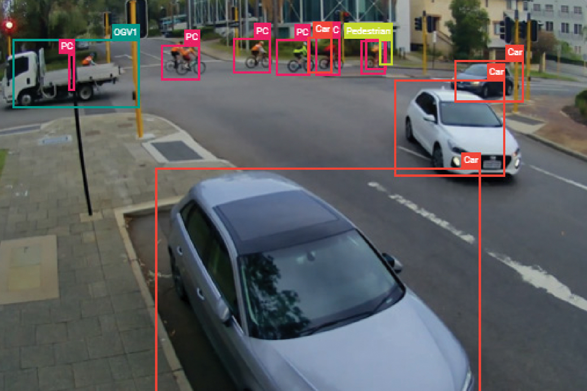
1. Road User Counts
We can count all road users entering a camera’s field of view and break this data down by time increment and user type.
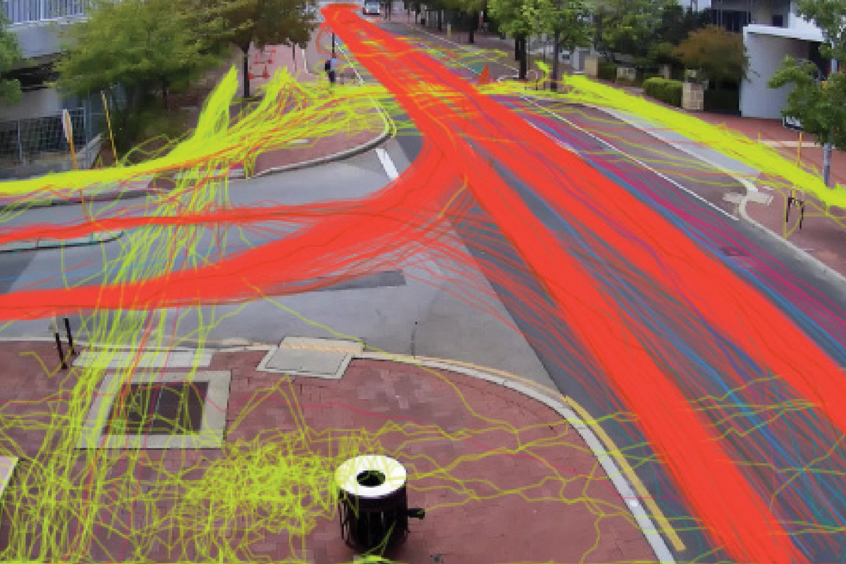
2. Road user path tracing
We can track the paths of movement made by users, which offers insights into traffic flow and directionality.
3. Road user speed analysis
We can measure user speeds, which is useful for congestion detection and shared path safety measures.
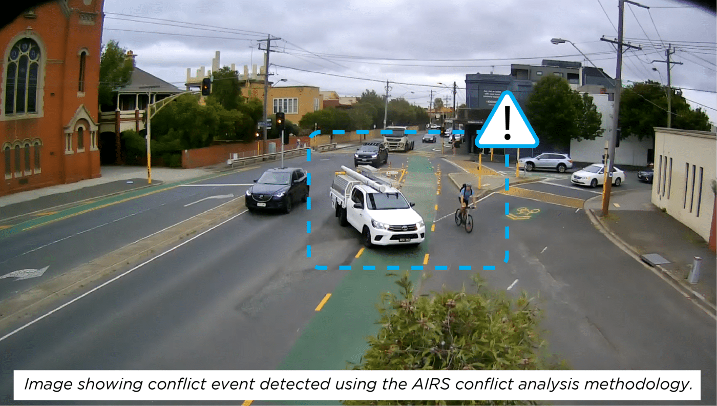
4. Near-Miss and Conflict Analysis
Using AIRS temporary surveys or sensors, Bicycle Network can complete a Near-Miss Analysis Study (otherwise known as Conflict Analysis). These studies can be completed on-road between bicycles, e-scooters and vehicles, or on pathways between pedestrians and riders.
We use a semi-automated methodology to identify potential conflicts using AIRS. These potential conflicts are then categorised by type of incident, and commentary is provided about the severity, cause, and response from road users involved.
5. Compliance
We can use the footage captured during an AIRS study to study the compliance of roads users with rules and signage, such as stop and give-way, helmet use, dismounting rules, speed limits and many more.
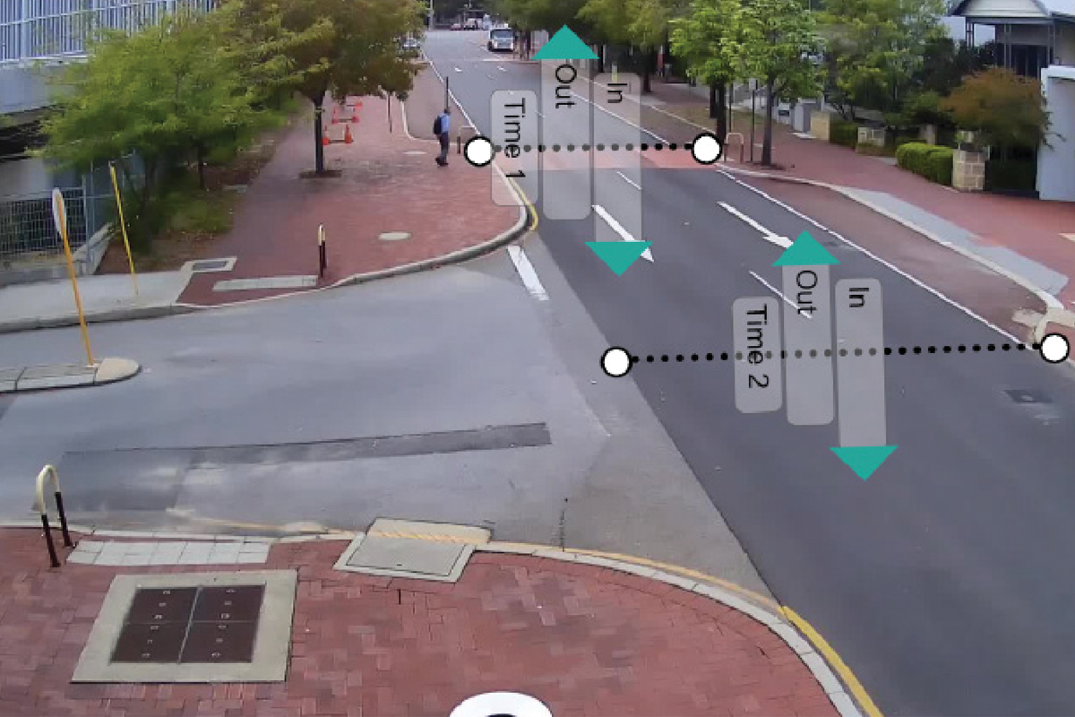
6. Queue Waiting Time Analysis
We can study the time taken for bike riders and pedestrians to cross an unsignalised crossing, or the waiting time for a rider or driver to make a turning movement at an intersection.
Data privacy
AIRS autonomously detects and classifies road users from video footage which is securely uploaded to an online recognition software platform.
The data that is presented to clients is anonymised and relates to population samples with no individualised user information. All footage is deleted from the online server no later than 60 days after the submission of the data to the client.
For more information, please review the information booklet and our privacy policy, or submit an enquiry below to schedule a conference call.
Latest AIRS news
Bicycle Network data improves bridge safety
The City of Melbourne recently engaged Bicycle Network to investigate the behaviours of riders and pedestrians on the southside landing of the green cable stay...
Auckland cycleway win thanks to Bicycle Network data
Auckland Transport has decided to retain the Coronation Road cycleway as part of the permanent road network thanks to transport data provided by Bicycle Network's...
Bicycle Network’s AI-powered transport surveys go international
Bicycle Network has partnered with Auckland Transport to take Artificial Intelligence Road Surveys (AIRS) international, across the ditch to New Zealand.
Using AI to study bike movements in Canberra
Bicycle Network has partnered with the ACT Government to undertake a week-long study for a newly constructed separated bike lane in central Canberra.
AI tool tackles conflict on Chapel Street
With a narrow unseparated bike lane and high risk of dooring, Chapel Street is a particularly harrowing street for bike riders in Melbourne...
AIRS technology hits Bundaberg
Bundaberg Regional Council is one of the latest municipalities to collect important transport data using Bicycle Network’s AIRS bike-counting technology.