
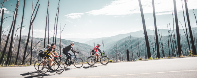
Whether you're currently training for Peaks, are thinking about taking up the challenge one day, or just love hills, we hope you enjoy this analysis of the climb up Mount Hotham, courtesy of Matt de Neef from theclimbingcyclist.com.
Hotham is a tough climb – and the second of the three at Peaks Challenge Falls Creek. However, at the top, you’re halfway there and have done around half the climbing metres. For most riders, it is important to NOT spend too much on this climb (if possible). If you can maintain tempo (~75% of max HR) you will leave enough in the tank for you-know-what!
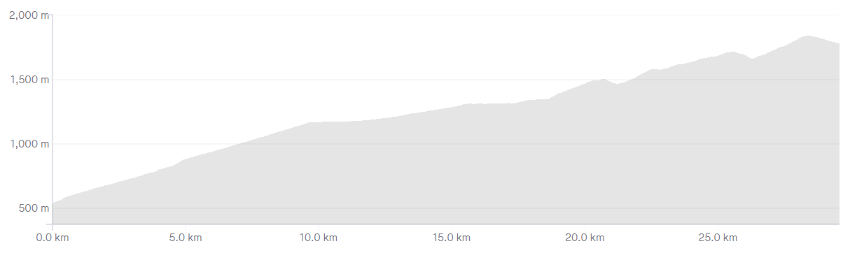
STATS
Length: 30.8km
Average gradient: 4.2%
Elevation gain: 1,279m
THE START
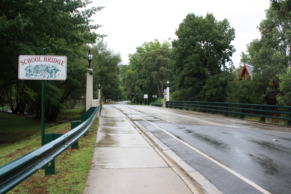
The Mount Hotham climb starts at the School Bridge in the alpine village of Harrietville.
THE END
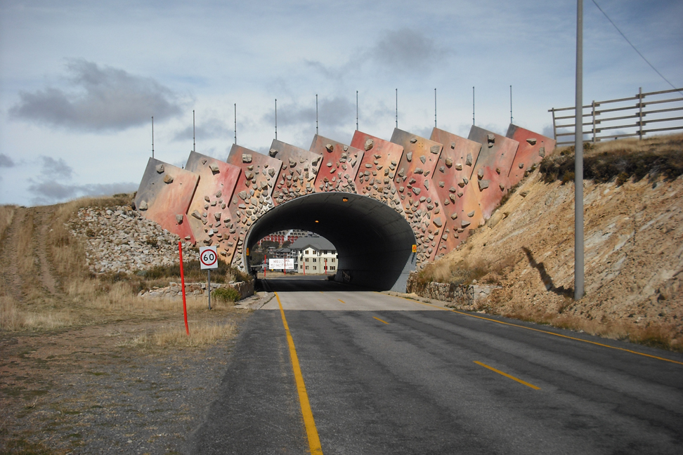
The Mt. Hotham climb concludes at the Hull Skier Bridge, the entrance to the Mt. Hotham Alpine Resort.
AT A GLANCE
- A long, challenging climb with three distinct sections, some steep ramps and great views.
- The first section is a steady 11km … except The Meg at the 5.6km mark (300m at ~10%).
- The second section is a long false-flat from 11km to 19.7km with only minimal climbing.
- The final section begins at 19.7km and features two short descents (at 22.9km and 27km).
- Oh, and CRB Hill at 23.5km (1.1km at 10%) and Diamantina at 28.3km (1.4km at 9%).
IN DETAIL
While the climbing doesn’t start immediately after the School Bridge, it doesn’t take long for the Great Alpine Road to ramp up. Bending sharply around to the left, the road takes on an initial gradient of around 6-7% which is maintained for several hundred metres. After 800m and a sharp right-hand bend, the road starts to flatten out as lush alpine forest surrounds the road.
2.7km from the School Bridge the road flattens off slightly, before a sweeping right-hand bend 300m later. After a further 300m the road bends around into a sweeping left-hand hairpin before straighening slightly. This first section of the climb is punctuated by a constantly-changing gradient with shorter, steeper sections being balanced out by comparatively easier sections.
4.4km into the climb the road gets noticeably steeper as it bends around sharply to the left. 800m further up the road there is a considerable break in the tree line and breathtaking views are possible to the right-hand side of the road. A further 400m up the road and the breathtaking views are put on hold momentarily as you get to the climb’s first major challenge: The Meg.
As the road bends sharply around to the left, it’s a 400m grind at around 9% before a slight crest brings about the return of a more friendly gradient. For the next few kilometres the road climbs slowly but steadily, twisting into a right-hand hairpin bend at the 8.2km mark. Another 2.8km further up the road – 11km from the start of the climb – the road flattens out dramatically, signalling the start of the climb’s second section – a 9km false-flat.
With the road meandering along at an almost-negligible gradient, terrific views of the summit are available at the 11.7km mark. 1.3km later the gradient increases marginally but not enough to cause significant discomfort. After winding gently for another 2.6km the false-flat turns into a brief downhill before flattening out once more. With the gradient still negligible, the Great Alpine Road meanders gently toward the 19.7km mark and the Buckland Gate.
After a pleasantly pedestrian false-flat section, Mt. Hotham’s final 11km come as a rather rude shock. From the end of the false-flat at the Buckland Gate the road kicks to around 7-8% as it passes a rather accurate sign: ‘Steep Climb – Engage Low Gear’. This steeper grade is maintaned for around 400m before things flatten out to a comparatively pleasant 6%. At the 21.4km mark the road emerges from the tree line and Mt. Hotham’s famous moonscape comes into view.
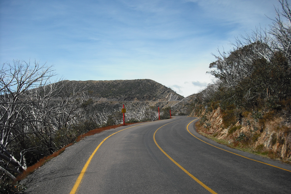
With the road now clinging to the ridge line, terrific views are possible on both sides of the road for most of the remaining climb. 1.5km after leaving the alpine forest behind, the road flattens out briefly before it plunges toward the valley. After descending sharply for 600m you will come face-to-face with one of the most iconic sections of the Mt. Hotham climb: CRB Hill.
1.1km at 10% might not sound all that challenging but after 22.7km of climbing this stretch makes for a slow and painful grind. CRB Hill ends at Renes Lookout as the road flattens off quite noticeably. 600m later the gradient increases again, with the road cutting through Mt. Hotham’s moon-like terrain.
After 400m of steeper climbing the road flattens out again and a more pedestrian grade is maintained for the next 700m. By this point you are well and truly into crosswind country and the road ramps upward once again, holding its gradient for the next 1.2km.
27km from the start of the climb you will reach Little Baldy Hill where the road drops toward the valley floor once more. After a sharp 600m descent the road heads skyward again, snaking its way majestically along the ridge line for 700m. At the 28.3km mark the going gets a little tougher as you come across another section that is steep enough to warrant its own name: the Diamantina.
At around 9% this 1.4km section is the final challenge and arguably the toughest section of the climb. After a slow grind to the top of the Diamantina the road reaches a crest at the 29.7km mark. By this time all of the hard work is done and you can roll down to the Hull Skier Bridge and the end of the Mt. Hotham climb.
LOCATION
The Mt. Hotham Alpine Resort is located approximately 350km north east of Melbourne and around 50km south east of the township of Bright. Visitors driving up from Melbourne are best advised to take the Hume Freeway (M31) to Wangaratta before turning east onto the Great Alpine Road (B500).
The Mt. Hotham climb is often attempted from the township of Bright with the 24km ride from Bright to Harrietville acting as a perfect warm-up. While shorter ride options are available, climbing Mt. Hotham without a proper warm-up is not advisable.
STRAVA
Want to see how your time up Mt. Hotham compares? A Strava segment for the Mt. Hotham climb can be found here.
Visit theclimbingcyclist.com for more excellent content about riding your bike up big hills.
Not afraid of Hotham? Why not enter Peaks Challenge Falls Creek to test yourself against not only Mount Hotham, but also:
- The climb: Mount Beauty to Tawonga Gap
- The climb: The back of Falls Creek
Become our friend
Find out more about Bicycle Network and support us in making it easier for people to ride bikes.