
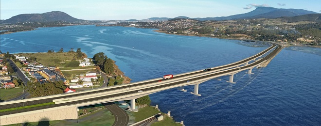
It seems paths on bridges is the flavour of the month, with consultation for a design for the new Bridgewater Bridge kicking off this week: https://stategrowthtas.mysocialpinpoint.com/newbridgewaterbridge
The “reference design” that has been put out for consultation includes a 3-metre-wide shared path on the downriver side of the bridge.
Considering the likely volume of users on the bridge and the path being set at bridge level with a high barrier between it and the traffic lanes, a 3 metre width is a good response.
The reference design will not be the final design. Once the department has received all the community comment two construction companies will have to the chance to tender to design and build the bridge. The successful company may want to change the design.
What is not clear from the reference design in the video or pinpoint map, is exactly where the path at either end will start and end and fit in with the most common riding routes.
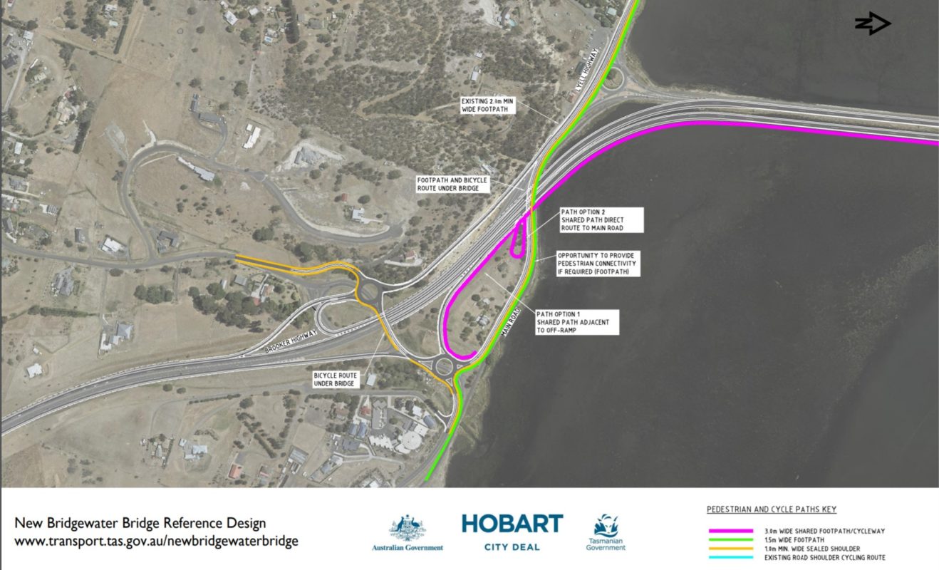
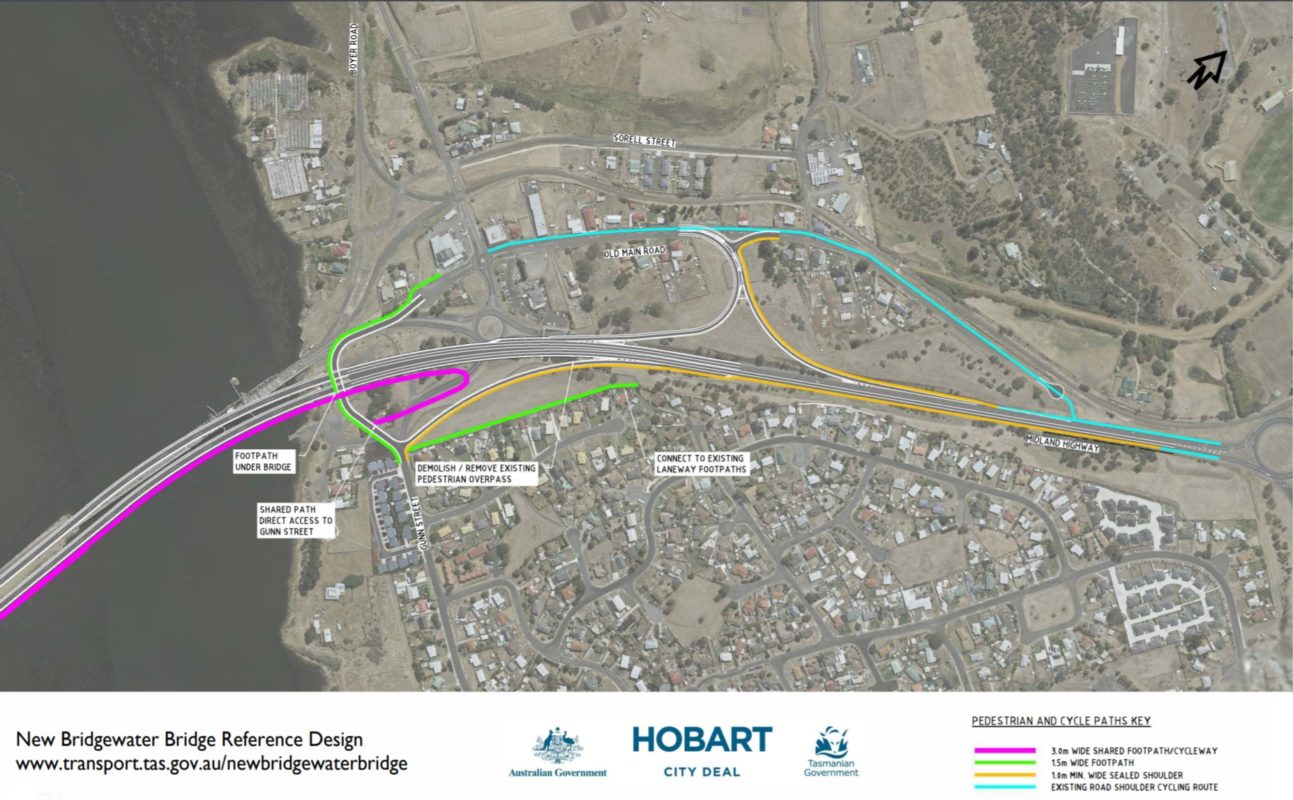
The department has put two maps up showing the connections, but these are difficult to find on the engagement page: https://www.transport.tas.gov.au/__data/assets/pdf_file/0008/265949/New_Bridgewater_Bridge_Reference_Design_-_Pedestrian_and_cycle_paths_-_October_2020.pdf
On the Brighton side of the river, the bridge access will be from Gunn Street, which will run under the new bridge, connecting to Old Main Road and Boyer Road and will have a 1.5-metre-wide footpath but no shoulders.
On the Granton side, the path access will be from Main Road, which will continue under the new bridge to join up with the Lyell Highway and have a 1.5 metre wide footpath and sealed shoulders. On the other side of Main Road, sealed shoulders will take cyclists to Black Snake Road.
Online design comment map
The Department of State Growth has a Social Pinpoint map up online for people to make comments on different elements of the design.
One commenter already has pointed out that Old Main Road is a good detour to get on to the current bridge and would hope access via that route for riders remains.
The only other comment regarding the shared path as we publish this is a desire for separated cycling and pedestrian paths rather than one shared path.
Many of the comments on the map relate to keeping the current bridge to preserve the rail corridor and a petition to the Premier protesting the move has already started up: www.change.org/p/premier-of-tasmania-new-bridgewater-bridge-needs-rail
If you want to ask questions in person, two community drop-in sessions have been organised for Wednesday 28 October at Brighton Civic Centre, 25 Greenpoint Road, Bridgewater at 10 am –1 pm and 4–7 pm.