
Traffic in Geelong looks set to be reordered around the central activities district under a forthcoming transport network operating plan (TNOP).
The plan will prioritise bikes on certain streets while prioritising motor traffic, pedestrians and freight on other routes, with the aim of making the road system safer and more efficient.
The plan will guide future decision making by the council and state government on street upgrades and other projects.
While the draft plan prioritises certain streets for cars, riders, trucks or pedestrians, it doesn’t exclude other modes of transport from those streets.
Geelong City has published the plan for community consultation.
Feedback can be provided here.
Once finalised and adopted, a 10-year year staged investment plan will be developed.
As the central Geelong road network is shared between the council and Regional Roads Victoria, implementation will be carried out in partnership with the State Government.
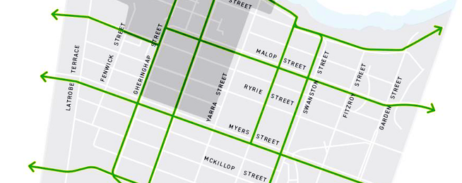
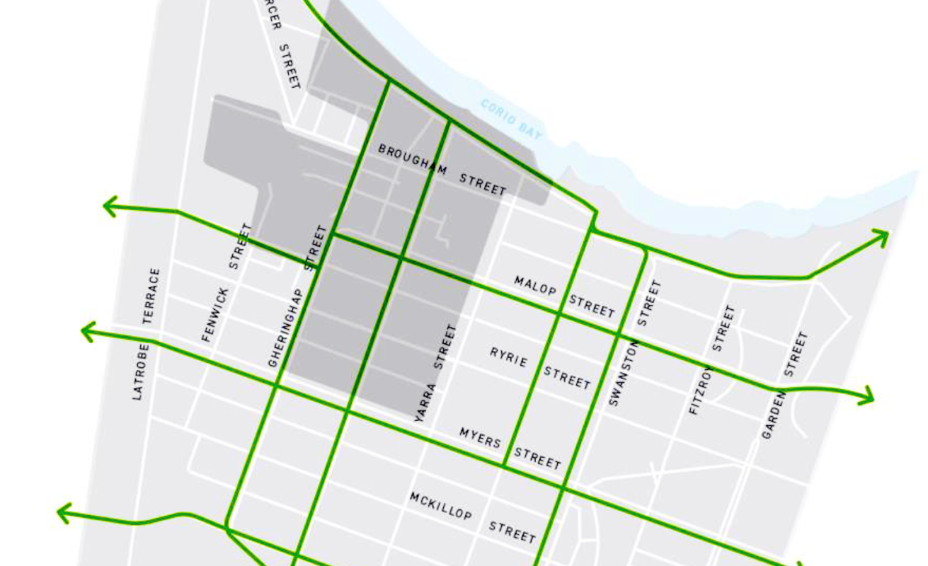
Under the draft plan, bikes will be prioritised on Gheringhap Street, Moorabool Street and Swanston Street, along with Kilgour Street, Myers Street, Malop Street and Western Beach Road.
The routes into the city are designed to provide direct access to and from the city, and, designed to provide great permeability and coverage of the city.
Latrobe Terrace, Ryrie Street, McKillop Street and Yarra Street would be prioritised as the key streets for vehicle traffic.
East-west freight movement would be directed to more southern routes in McKillop Street, Fyans Street and Breakwater Road, taking pressure off Ryrie Street.
A grid of CBD streets bound by Gheringhap Street, Myers Street, Bellarine Street and the waterfront would be focussed on pedestrian movement and accessibility.
The City says the draft TNOP has been designed to work hand-in-hand with other key transport strategies relating to parking, freight movement, and the planned rail duplication between South Geelong and Waurn Ponds station.
It has been created by technical experts in consultation with Public Transport Victoria, VLine, the Public Transport Users Association, bicycle user groups and members of council’s Disability Access Committee.
"It is important how we use and operate our road network to support a functional and sustainable transport system for the city, the City says.
"We need a smarter approach to managing our road network – one that resolves competing interests for limited available road space, makes the best use of our existing roads and supports people to make alternate choices about what type of transport to use and when."
"While new infrastructure plays an important role in growing a City, we must also better manage our existing road network."
Click here to download a copy of the plan
Become our friend
Find out more about Bicycle Network and support us in making it easier for people to ride bikes.