Commuting to work and education is about to get a whole lot easier and healthier for people in Geelong.
Two new cycling corridors – one from the south and another from the west – are due to be rolled out this year.
The routes will be some of the first in the series of strategic cycling corridors that will form the core of a high quality bike network that will be incrementally expanded in regional cities, major towns and in Melbourne, over the next 15 years.
The corridors will be built to a much higher standard of convenience and safety: consider them as the arterials of the bike world.
The corridors will mostly be routes protected from traffic, or on calm, low traffic streets, or totally off-road.
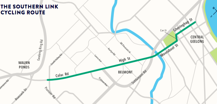
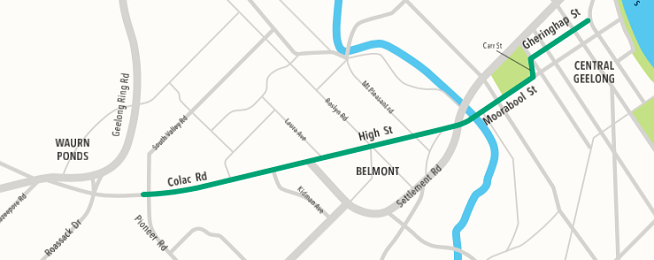
Geelong’s southern link extends from the city taking in Gheringhap, Moorabool and High Streets, then Colac Road to Waurn Ponds.
This is a quick and direct link that will be attractive to riders of all ages and abilities and links to key employment, shopping and education destinations.
Not to mention, going right past Kardinia Park! Lets hope there is plenty of bike parking at the ground.
Inevitably, there has been opposition from some traders in Belmont whom, like traders all over the world, think all their customers use the parking space outside their front door.
Investigations by the council have demonstrated that Belmont has a massive supply of car parking only minutes walk from the traders, and that at any given moment more than 100 spaces are always vacant.
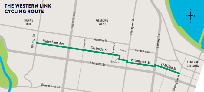
The Western Link will connect central Geelong to Herne Hill, via Geelong West along Little Malop Street, Villamanta Street, Gertrude Street and Sydneham Avenue.
This will be an innovative project as it involves cars and bikes sharing streets, where bikes will have priority, and traffic will be slowed.
These treatments are just starting to appear in Australia, although they have proved very successful internationally.
Residential streets benefit from the traffic calming, and safety for locals, especially children, is greatly improved.
Again, some residents have complained that “their” on-street car parking is being interfered with.
They should realise that this $4.7M project is ultimately being funded by the TAC, Victoria’s road safety agency, which now calls Geelong home.
The Geelong community should be committed to the TAC mission of safer streets for pedestrians and bike riders, and accept that the sanctity of human life has a higher priority than storing your private car on the publicly owned street.
Bicycle Network has worked with VicRoads and the council since 2014 to guide the development of these projects. The options being considered are well founded and we are sure the final results will bring tremendous benefits for Geelong when they are completed next year.
The council is accepting comments until Monday. Have your say here.